Falling Down the Thames Blog 24, 27th August 2014
When and Where
Krista and I have been making plans for our great British paddling adventure, Falling Down the Thames, for the past year. As each component of the trip has consolidated, the trip has achieved greater clarity. The day on which we begin the journey is now less than nine months away.
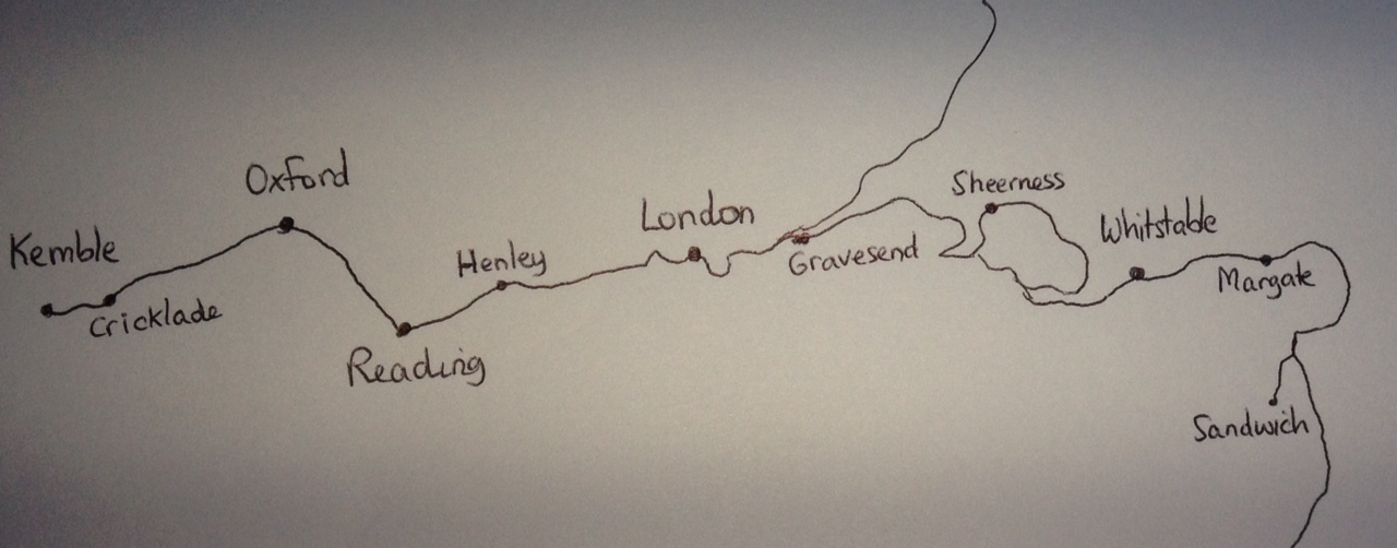
Both Krista and I have been on lengthy wilderness paddling adventures in the past, but this journey is something quite different. Four hundred and sixteen kilometres from Kemble in Gloucestershire, we will cruise through Oxford, Reading, Henley and Windsor, through the heart of London, all along the length of the River Thames and then the Thames Estuary, and finally along the north and east shores of Kent. We will visit eight counties, pass under 130 bridges, and navigate almost four dozen locks.
This past week, our planning reached a milestone. We are pleased to report that we have settled on an itinerary. We can now say with a degree of confidence when we will arrive at each new station in our journey. Perhaps reading our schedule will give you a small thrill.
Day 1: Tuesday April 21 – Kemble to Cricklade
Walking /Paddling distance 17.12 km / 10.64 mi
Day 2: Wednesday April 22 – Cricklade to Tadpole Bridge
Paddling distance 34.47 km / 21.42 mi
Day 3: Thursday April 23 – Tadpole Bridge to Oxford – Folly Bridge
Paddling distance 33.43 km / 20.77 mi

Folly Bridge, Oxford
Day 4: Friday April 24 – Oxford – Folly Bridge to Pangbourne / Whitchurch Lock
Paddling distance 50.26 km / 31.23 mi
Day 5: Saturday April 25 – Pangbourne / Whitchurch Lock to Henley Bridge
Paddling distance 25.36 km / 15.76 mi
Day 6: Sunday April 26 – Henley Bridge to Boulters Lock
Paddling distance 23.53 km / 14.62 mi
Day 7: Monday April 27 – Boulters Lock to Penton Hook Lock
Paddling distance 26.38 km / 16.39 mi
Day 8: Tuesday April 28 – Penton Hook Lock to Teddington Lock
Paddling distance 24.12 km / 14.99 mi
Day 9: Wednesday April 29 – Teddington Lock to Westminster Bridge
Paddling distance 24.27 km / 15.08 mi

Westminster Bridge, London
Day 10: Thursday 30 April – Westminster Bridge to North Woolwich
Paddling distance 16.33 km/ 10.15 mi
Day 11: Friday May 1 – North Woolwich to Gravesend
Paddling distance 29.8 km / 18.5 mi
Day 12: Saturday May 2 – Gravesend to Sheerness
Paddling distance 33.7 km / 20.9 mi
Day 13: Sunday May 3 – Sheerness to Whitstable
Paddling distance 22.4 km / 13.9 miles
Day 14: Monday May 4 – Whitstable
A day of rest at the Whitstable May Day Festival
Day 15: Tuesday May 5 – Paddle to Maunsell Sea Forts from Whitstable
Paddling distance uncertain

Maunsell Sea Forts
Day 16: Wednesday May 6 – Whitstable to Margate
Paddling distance 27.9 km / 17.3 mi
Day 17: Thursday May 7 – Margate to Richborough
Paddling distance 30.8 km / 19.1 mi
- Glen
Photo credits: hand-drawn map of the Falling Down the Thames route – Dr Krista Halling; Folly Bridge, Oxford - Daniel L. Johnson (www.danlj.org); Westminister Bridge - nexttriptourism.com; Maunsell Sea Fort – hdwallpapersfactory.com