Falling Down the Thames Blog 39, 10th December 2014
Lost Rivers of London
Last week I wrote about the rivers that feed the River Thames as it flows through London. Long hidden below the streets of the great city, The Wandle, the Walbrook, the Neckinger and the Effra are among London’s lost river.
“The Fleet is probably the best known of London’s missing rivers…and has secured a lasting place in London culture and mythology.” These are the words of Tom Bolton in his fabulous 2011 book London’s Lost River: A Walker’s Guide. At its height, the Fleet inlet was London’s busiest port. Tom explained that the people and industries that grew up alongside the River Fleet made the river insufferable (“London’s foulest sewer,” according to Tom) by the late 17th century. Efforts to cover the Fleet over began in 1732, and by 1769 most evidence of the river had been lost.
Lost, except to an expert…

Fleet Street Sewer 1854
Krista and I have consulted with endless experts about our upcoming Falling Down the Thames paddling adventure, and almost every one has responded with grace and enthusiasm. This has been one of the great joys of planning for FDtT. Tom Bolton was one of these who responded with a happy heart. He suggested that walking the lower Fleet from King’s Cross to Blackfriars would take us about two hours.
In his book, Tom explained that the River Fleet has two sources on Hampstead Heath and these flow along independent routes until joining at Kentish Town. Even after it disappears underground, evidence of the Fleet remains. At the intersection of Royal College Street and Lyme Street is the Prince Albert pub. “The Fleet flows under a circular drain cover in the road outside, and cannot only be heard but also seen, deep below the grating.” This sort of thing makes me tingle.
If I have followed Bolton’s narrative correctly, from King’s Cross we will find our way to Gray’s Inn Road. Then it is St. Chad’s Place, to Wicklow Street to King’s Cross Road. Calthorpe Street will take us to Phoenix Place. We will walk along Warner Street and turn left along Ray Street at a pub. Passing over Ray Street Bridge, we will turn right down Farringdon Lane. Then we will cross Clerkenwell Road, and head down Turnmill Street, turning right at an intersection with Cowcross Street. We will continue along Farringdon Street, as it becomes New Bridge Street. Crossing Victoria Embankment, and turning right down steps will lead us to the river path at the foot of Blackfriars Bridge. At the Blackfriars Pier platform, by looking back toward the bridge, we will be able to see the outfall sewer of the River Fleet.
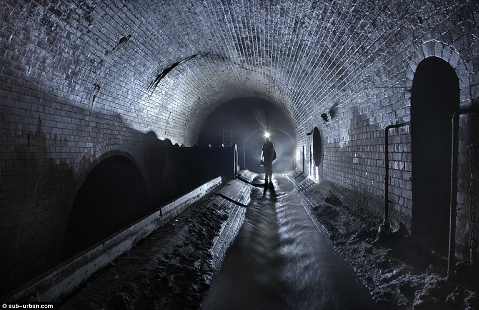
The River Fleet, as it looks today.
And so, at 07:30 on Thursday April 30, Tom will meet Krista and me at King’s Cross to begin tracing the route of the River Fleet. He also suggested that we might wish to encourage others to join us in our adventure by advertising the event on the Walking Artists Network website. And, at this time, I would like to formally invite you to join in. If it sounds like fun, and you would like more details, please write to me at glen@glenchilton.com.
- Glen
Photo credits: the River Fleet, www.dailymail.co.uk/news/article-2038281/London-underground-photos-Miles-ornate-brickwork-tunnels-hidden-Fleet-River.html
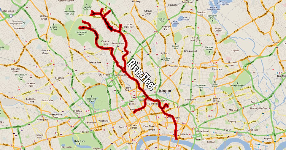
Click on the map of the River Fleet for a larger version.